GPS Collar Gorilla Tracking Research: Understanding GPS Technology in Mountain Gorilla Conservation
Modern conservation relies on scientific research and innovative technology to protect endangered wildlife. Around the world, researchers use GPS collars to study elephants, lions, wolves, leopards, and many other mammals. These tracking devices provide valuable information about animal movements, habitat use, and migration patterns. As a result, many people ask whether researchers also use GPS collars when studying mountain gorillas. The topic of gps collar gorilla tracking research has gained attention as travelers and conservation supporters seek to understand how technology contributes to gorilla protection in Uganda, Rwanda, and the Democratic Republic of Congo.
Mountain gorilla conservation follows a different approach from many other wildlife research programs. Conservation organizations place the welfare of every gorilla above all other considerations. Instead of routinely fitting gorillas with GPS collars, researchers depend on experienced ranger trackers, direct field observations, habitat mapping, camera traps, satellite imagery, and other non-invasive technologies. These methods provide reliable scientific information while protecting the health and natural behavior of mountain gorillas.
Understanding how GPS technology supports conservation allows visitors to appreciate the careful balance between scientific research and wildlife welfare.
What Is GPS Collar Tracking?
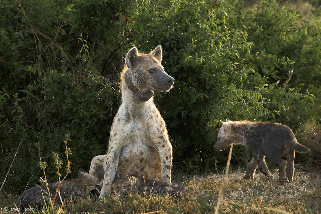
A GPS collar is a tracking device placed around an animal’s neck to record its geographic location at regular intervals. The collar communicates with satellites and stores or transmits location data that researchers analyze later.
Scientists use GPS collars to understand how animals move through their habitats, identify seasonal movement patterns, estimate home ranges, and study interactions with the surrounding environment. This information helps conservation managers protect important habitats and reduce conflicts between wildlife and human activities.
Although GPS collars have transformed wildlife research for many species, gps collar gorilla tracking research requires a different conservation strategy because of the unique biology and social behavior of mountain gorillas.
Why Mountain Gorillas Are Generally Not Fitted with GPS Collars
Mountain gorillas receive continuous monitoring through well-established conservation programs that have operated successfully for decades.
Every habituated gorilla family receives regular visits from trained trackers and researchers who record detailed information about the animals’ health, movements, family structure, feeding behavior, and habitat use. This daily monitoring provides extensive scientific data without requiring researchers to attach tracking devices to individual gorillas.
Conservation organizations carefully evaluate any research method that involves direct contact with endangered animals. Because existing monitoring systems already provide excellent information, researchers generally prefer non-invasive techniques that avoid unnecessary disturbance.
For this reason, discussions about gps collar gorilla tracking research often focus on why alternative monitoring methods better support mountain gorilla conservation.
How GPS Technology Supports Gorilla Research
Although researchers do not routinely place GPS collars on mountain gorillas, GPS technology remains an essential conservation tool.
Field teams use handheld GPS devices to record gorilla nest locations, feeding sites, movement routes, patrol paths, research stations, and important habitat features. These geographic records help scientists create accurate maps of gorilla territories and understand how gorillas use different parts of the forest throughout the year.
GPS data also allows conservation managers to monitor changes in habitat quality and evaluate long-term conservation strategies.
This practical application makes GPS technology an important part of gps collar gorilla tracking research even without attaching collars to the animals.
Habitat Mapping and Forest Monitoring
Healthy forests provide everything mountain gorillas need to survive, including food, shelter, nesting sites, and water sources.
Researchers combine GPS mapping with satellite imagery and geographic information systems to monitor changes in forest cover, identify habitat corridors, and detect environmental pressures that could threaten gorilla populations. These detailed maps allow conservation organizations to prioritize habitat protection and restoration projects.
Accurate mapping supports informed conservation decisions while strengthening long-term ecosystem management.
Technology helps researchers protect habitats before problems become severe.
Supporting Ranger Patrols
Wildlife rangers remain the foundation of mountain gorilla conservation.
GPS technology helps patrol teams navigate difficult terrain, record observations, document illegal activities, and monitor conservation efforts throughout protected areas. Rangers can accurately record the locations of gorilla groups, snares, damaged habitats, or other important findings during daily patrols.
These records improve coordination among conservation teams and support evidence-based management decisions.
Within gps collar gorilla tracking research, GPS navigation strengthens field operations without affecting the gorillas themselves.
Combining GPS with Other Technologies
Modern conservation increasingly combines several technologies to improve scientific understanding.
Researchers integrate GPS mapping with camera traps, drone surveys, satellite imagery, acoustic monitoring, artificial intelligence, and detailed field observations. Together, these tools create a comprehensive picture of gorilla habitats and ecosystem health.
Camera traps capture wildlife activity throughout the forest, drones monitor habitat conditions in selected conservation projects, and artificial intelligence helps organize large research datasets. GPS provides the geographic framework that connects all of these information sources.
This integrated approach allows scientists to study ecosystems more effectively while minimizing disturbance to wildlife.
Ethical Considerations in Gorilla Research
Every research project involving endangered wildlife must follow strict ethical standards.
Mountain gorillas share close genetic similarities with humans, making them particularly sensitive to disease transmission and unnecessary stress. Conservation organizations therefore prioritize research methods that protect both physical health and natural behavior.
Before introducing any new technology, researchers carefully evaluate potential benefits alongside possible risks. This cautious approach ensures that scientific progress never compromises animal welfare.
Ethical decision-making remains central to every discussion involving gps collar gorilla tracking research.
Future Innovations in Gorilla Monitoring
Technology continues to evolve rapidly, creating new opportunities for conservation science.
Future developments may include improved satellite monitoring, advanced environmental sensors, artificial intelligence image analysis, more accurate habitat mapping, and enhanced remote data collection systems. These innovations could improve conservation planning while maintaining the non-invasive approach that has contributed to mountain gorilla recovery.
Rather than relying on GPS collars, future research will likely continue expanding technologies that collect accurate information without directly affecting gorilla behavior.
Innovation and conservation will continue working together to protect mountain gorillas.
How Responsible Tourism Supports Research
Every gorilla trekking permit contributes directly to conservation efforts.
Tourism revenue helps fund ranger patrols, scientific research, veterinary care, habitat protection, community development, and conservation education. Visitors who follow park regulations also support ongoing research by minimizing disturbances to gorilla families during trekking activities.
Responsible tourism provides both financial resources and public awareness that strengthen long-term conservation programs.
Every visitor plays a role in protecting mountain gorillas.
Conclusion
GPS collar gorilla tracking research demonstrates how modern conservation combines technology with ethical wildlife management. While researchers generally do not place GPS collars on mountain gorillas, GPS mapping remains an essential tool for studying habitats, supporting ranger patrols, monitoring ecosystems, and improving conservation planning. Combined with camera traps, satellite imagery, artificial intelligence, and decades of field research, GPS technology helps conservation organizations protect one of the world’s most endangered great apes.
As scientific tools continue to improve, conservation programs will gain even better ways to monitor gorilla habitats while maintaining the highest standards of animal welfare. This balanced approach ensures that research supports both the long-term survival of mountain gorillas and the unforgettable experiences enjoyed by future generations of gorilla trekkers.