Altitude and Terrain in Volcanoes National Park
Rwanda gorilla trekking terrain. Volcanoes National Park rises across the high volcanic ranges of northern Rwanda. The park’s altitude and rugged terrain shape every trek, from short hikes to full gorilla tracking adventures. Understanding this landscape helps trekkers prepare well and enjoy the journey with confidence.
The High Elevation of Volcanoes National Park
The park sits at an average elevation of 2,400 to 4,507 meters above sea level. The higher slopes of the Virunga Volcanoes create a cool climate and thin air. Trekkers feel the altitude as they climb, so steady movement and frequent breaks help the body adjust. The elevation also gives you sweeping views of rolling hills, crater lakes, and mist-covered forests.
The Virunga Volcanoes
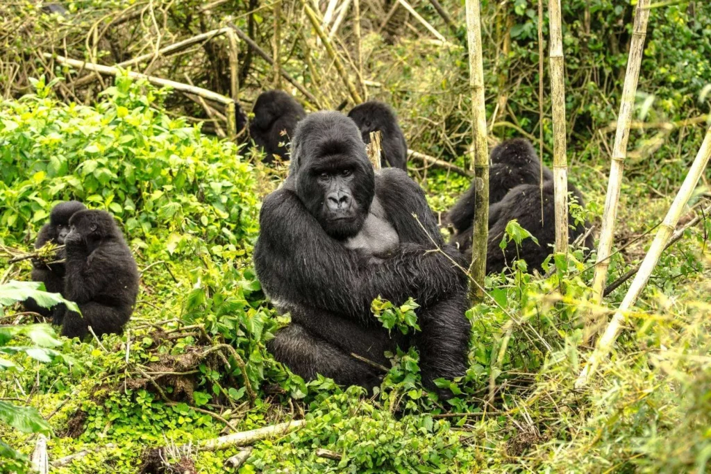
Volcanoes National Park forms part of the Virunga Massif. Five volcanoes sit inside the Rwandan side of the massif. These include Karisimbi, Bisoke, Muhabura, Gahinga, and Sabyinyo. Each volcano rises with steep sides and thick vegetation. Trails on these slopes challenge trekkers with uneven ground, rocky patches, and bamboo zones.
Terrain Zones Inside the Park
The park holds different terrain zones that change with elevation. The lower slopes feature farmlands and open vegetation. Bamboo forests cover the mid-altitude zones, and these areas host many gorilla families. Higher slopes shift into Hagenia-Hypericum forests. These zones feel cooler and wetter because they hold thick canopies. Alpine meadows sit near the upper slopes, where the vegetation grows low and hardy.
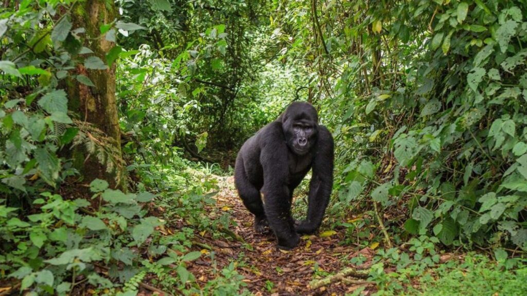
Trails Used for Gorilla Trekking
Gorilla trekking trails cut through thick bamboo, wet undergrowth, and steep ridges. Rangers guide trekkers along narrow forest paths that twist through vegetation. Some trails feel slippery after rain, so proper hiking boots improve grip. The terrain keeps changing, so trekkers use hands to pull through bamboo stems or lean on a walking stick for support.
Altitude Effects on Trekkers
Altitude affects breathing, heart rate, and movement. Many trekkers notice heavy breathing as they climb. Short rests help the body adjust. Hydration helps maintain energy on steep slopes. Rangers set a pace that supports every group member. A porter also lightens your load so you move steadily.
Weather Influenced by Altitude
The high altitude creates cool temperatures throughout the day. Morning mist covers the forest and softens visibility. Afternoon rains fall often, especially from March to May and October to November. Wet conditions turn trails muddy and slippery. Light layers, waterproof clothing, and strong boots help you tackle this terrain.
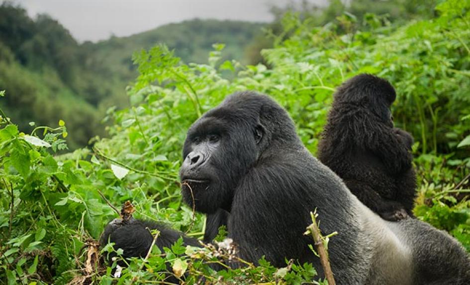
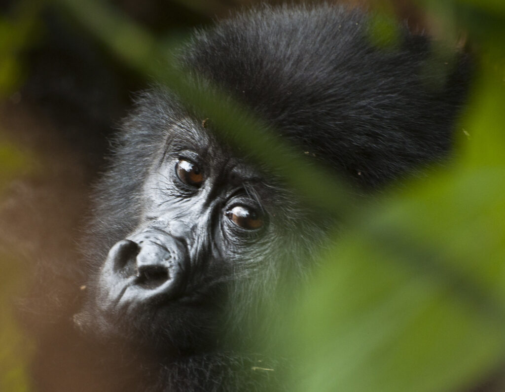
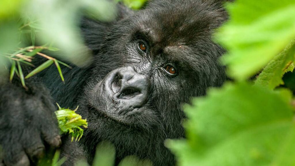
Wildlife Distribution Along the Rwanda gorilla trekking terrain
Different wildlife species occupy different altitude zones. Mountain gorillas prefer bamboo and Hagenia-Hypericum forests. Golden monkeys live in bamboo thickets on the mid-slopes. Buffaloes, duikers, and forest birds move between the lower and mid-level zones. The terrain influences where trackers find each species.
Preparing for the Altitude and Terrain
Trekkers prepare with good fitness, proper gear, and mental readiness. Light stretching and slow pacing help you move comfortably. A walking stick supports balance on uneven paths. Waterproof boots and gaiters keep your feet dry. A porter makes the trek easier by carrying your backpack and guiding you through tough sections.
Plan Your Gorilla Trek
Understanding the altitude and terrain in Volcanoes National Park prepares you for a rewarding and smooth trekking experience. You enjoy the forest more when you know what to expect on the trail.
For gorilla permits, tailored trekking tours, and lodge bookings, inquire and book with us at https://www.gorilla-permits.com.