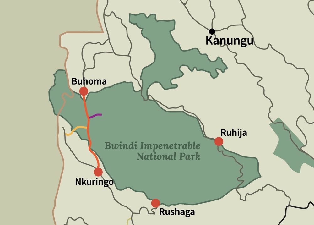
Map of Bwindi Impenetrable National Park
Gorilla trekking map. Bwindi Impenetrable National Park spans approximately 321 square kilometers of dense, tropical rainforest in southwestern Uganda. Understanding the park’s layout is essential for planning your gorilla trekking adventure and exploring its unique biodiversity.
Trekking Zones and Gorilla Habitats
Bwindi is divided into several trekking zones, each with its own gorilla families and terrain challenges:
- Nkuringo Sector: Located in the southern part of the park, it is less crowded and known for its steep trails.
- Rushaga Sector: A popular trekking area in the south-central park with lush vegetation and several habituated gorilla groups.
- Ruhija Sector: Situated in the northeast, Ruhija offers beautiful landscapes and bird-watching opportunities alongside gorilla tracking.
- Buhoma Sector: The northern sector, close to Kisoro, is the most accessible and frequently visited by tourists.
Each sector managed to ensure visitor safety, minimize environmental impact, and protect the mountain gorillas’ natural habitats.
Entry Points and Surrounding Communities
Bwindi has multiple entry points, with trailheads close to surrounding villages. Local communities engage in tourism by offering guiding, accommodation, and cultural experiences, which makes the park a hub for both wildlife and cultural tourism.
Navigating the Park
Maps of Bwindi highlight trekking routes, ranger stations, and gorilla family locations. While some trails are steep and challenging, they are well-marked and guided by expert rangers. GPS-assisted mapping helps visitors plan the most suitable routes for their trekking fitness level and interests.
Plan and Book with Us
With Gecko Safaris Africa, you can access detailed park maps and expert guidance to make your trek efficient, safe, and memorable. We ensure a well-planned, informative, and thrilling adventure through Bwindi’s dense forest. Contact us to plan and book your gorilla trekking adventure today.